In May 2012, the Prime Minister signed a directive declaring a moratorium on the granting of new Economic Land Concessions (ELCs). The directive also announced a systematic review of ELCs, which has so far failed to resolve long-standing land disputes linked to such concessions.
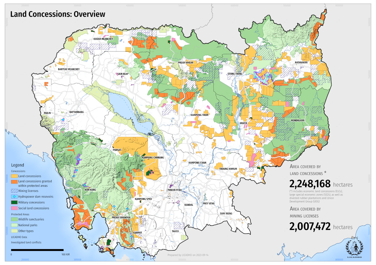
Years have passed since then, and the government has yet to fully disclose the extent of its grand land giveaway – or the exact location of the 2.1 million hectares of Cambodian land covered by existing land concessions.
LICADHO is releasing its land concession dataset and urges the government to fully disclose all concessions. We hope this information can contribute to the debate on the ELC scheme, including on its social and environmental impacts.(មើលជាភាសាខ្មែរ)
Caveat: LICADHO has collected and managed data on land concessions for over five years, however, due to the government's lack of transparency, it remains incomplete and may contain some inaccuracies. Crop data is collected from concession documents as well as field surveys. Not all concessions have been fully put to their stated use.
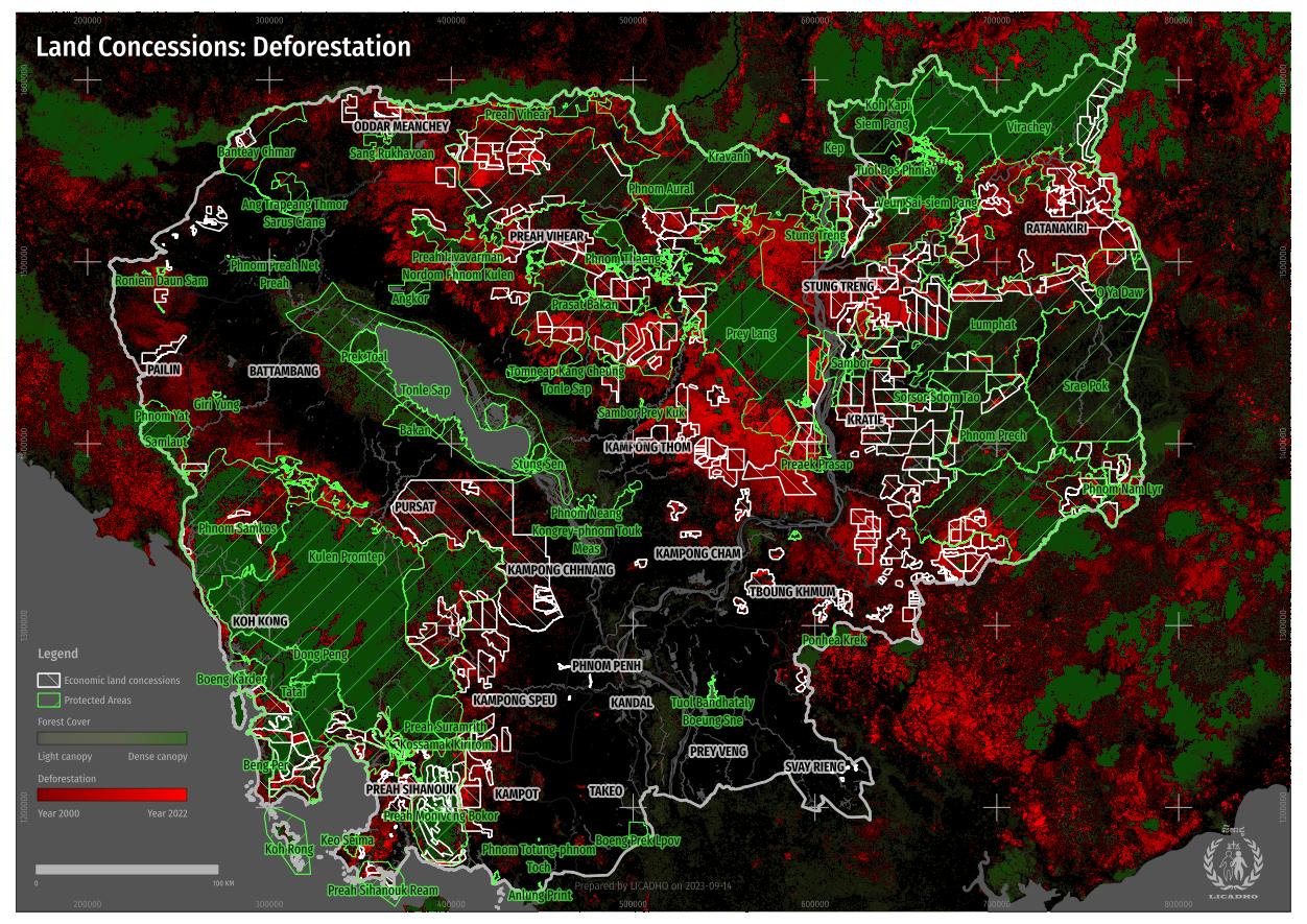
The deforestation dataset is part of a project by the University of Maryland to track forest change around the globe.
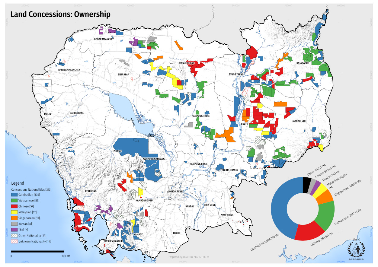
Land Concessions: Ownership Resolution: Low / High (A3)
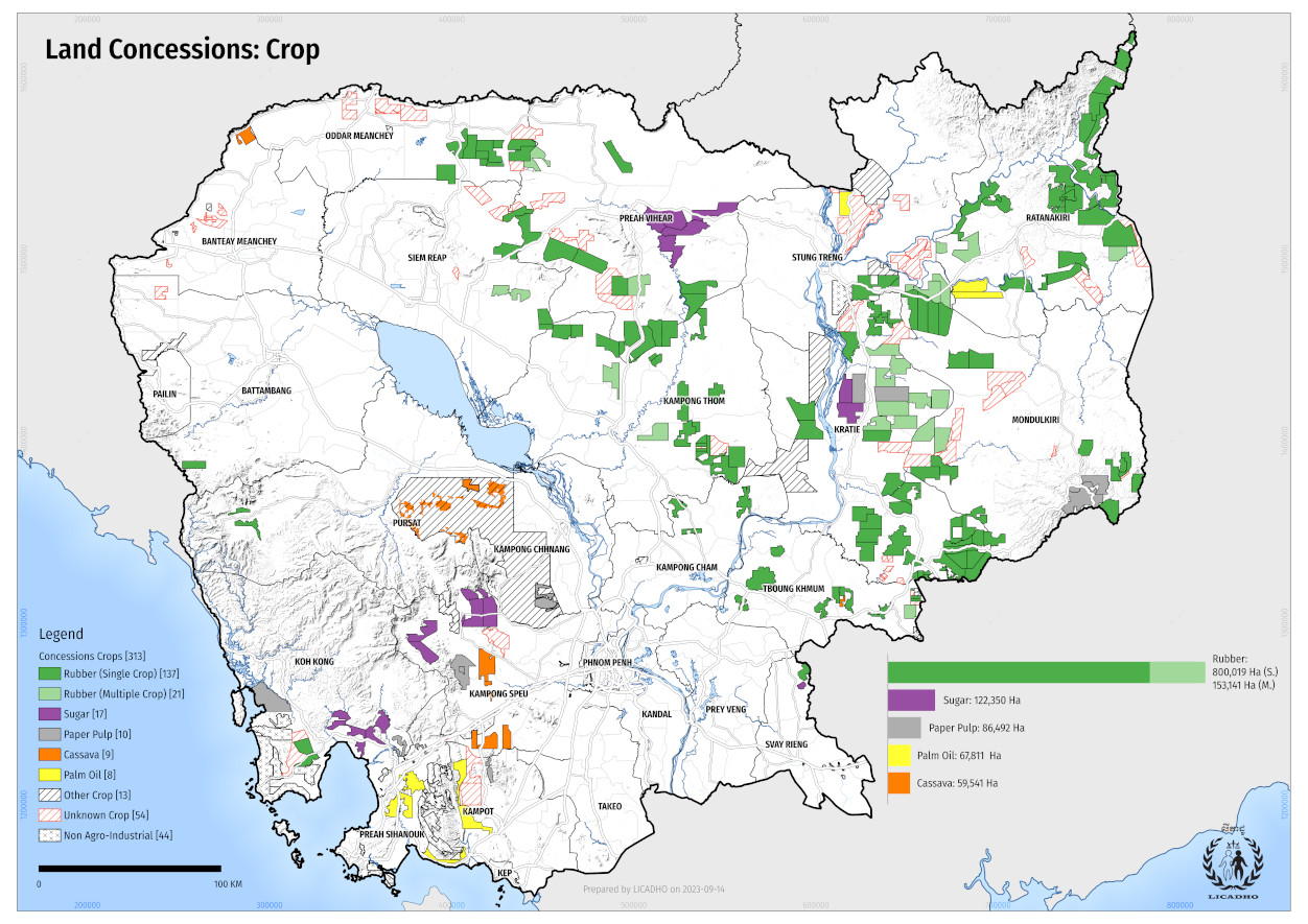
Land Concessions: Crop Resolution: Low / High (A3)
Land Concessions: Deforestation Resolution: Low / High (A3)
For those interested in the spatial data of land concessions featured on this page, you can download it in multiple formats: Shapefile, Google Earth's KML, or GeoJSON.